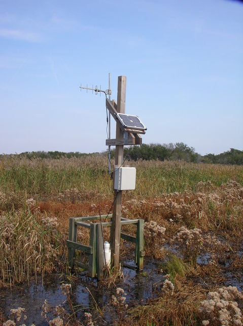
 A network of wells monitor changes in groundwater at several sites in the VCR/LTER, including the terrestrial chronosequence and interdial marshes on Hog Island and the Phillips Creek mainland marsh. On the barrier islands rainwater slowly percolates down through the sand, with relatively little mixing, so a "lens" of freshwater develops on top of the more dense underlying salt water. Land elevation and distance to the freshwater lens influences the type of vegetation that develops on the barrier islands. In high marshes the process is similar, except that periodic flooding with salt water can result in more brackish conditions. A network of wells monitor changes in groundwater at several sites in the VCR/LTER, including the terrestrial chronosequence and interdial marshes on Hog Island and the Phillips Creek mainland marsh. On the barrier islands rainwater slowly percolates down through the sand, with relatively little mixing, so a "lens" of freshwater develops on top of the more dense underlying salt water. Land elevation and distance to the freshwater lens influences the type of vegetation that develops on the barrier islands. In high marshes the process is similar, except that periodic flooding with salt water can result in more brackish conditions. |
Raw DataWater Levels |
Virginia Coast Reserve Long-Term Ecological Research
Ecological Research on a High-Speed Landscape: Developing a predictive understanding of how long-term change and short-term disturbance control the dynamic nature of coastal barrier landscapes.