NORTHAMPTON COUNTY HOME PAGE

NORTHAMPTON COUNTY
VIRGINIA
Geographic Information System
This server currently contains ARCExport data
files as well as documentation
and browse images. Contact
John Porter
about obtaining copies of any GIS data layers not directly available.
MAIN MENU
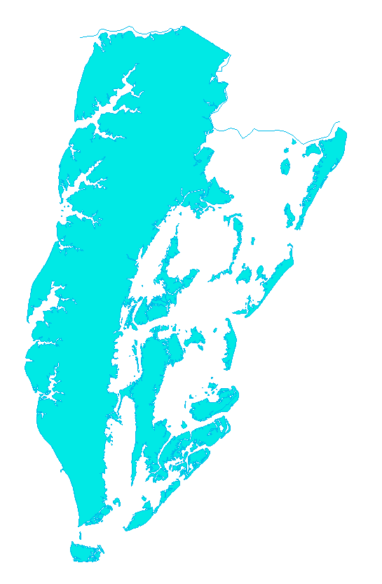
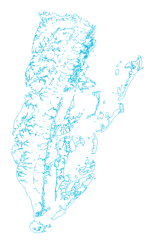
HYDROGRAPHY
1:100,000-Scale Digital Line Graphs (DLG)
ArcView coverage name: H100K.
Description: Sumberged, tidal, wetland
and shoreline features.


<-- Area (polygon) and line (arc) -->
coverages.
Also Available:
BASEMAP ArcView Coverage Name: OUTLINE
Description: Shoreline and northern county boundary line.
This coverage can be used as a basemap for other coverages.
Click Here for Quick Metadata.
Click Here for Complete Metadata.
Click Here for ARCE data files.
BACK to MAIN MENU
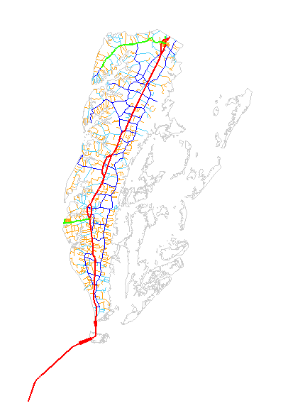
TRANSPORTATION
1:100,000-Scale Digital Line Graphs (DLG)
 ROAD and TRAIL FEATURES
ArcView coverage name: RTF100k
Description: Road type and structure classifications.
Road names when available.
Click Here for Quick Metadata.
Click Here for Complete Metadata.
Click Here for Big USGS Code List.
Click Here for ARCE data files.
 RAILROAD FEATURES
ArcView coverage name: RRF100K
Description: Active and inactive railroad lines.
Click Here for Quick Metadata.
Click Here for Complete Metadata.
Click Here for Big USGS Code List.
Click Here for ARCE data files.
 MISC. TRANSPORTATION FEATURES
ArcView coverage name: MTF100K
Description: Airports and transmission lines.
Click Here for Quick Metadata.
Click Here for Complete Metadata.
Click Here for Big USGS Code List.
Click Here for ARCE data files.
TOWN of CAPE CHARLES
1:6000-scale
ArcView coverage name: town
Description : Streetmap for the town of Cape Charles, VA.
Contains roadclass, street names and USGS road code attributes.
Click Here for Quick Metadata.
Click Here for Complete Metadata.
Click Here for ARCE data files.
BACK to MAIN MENU
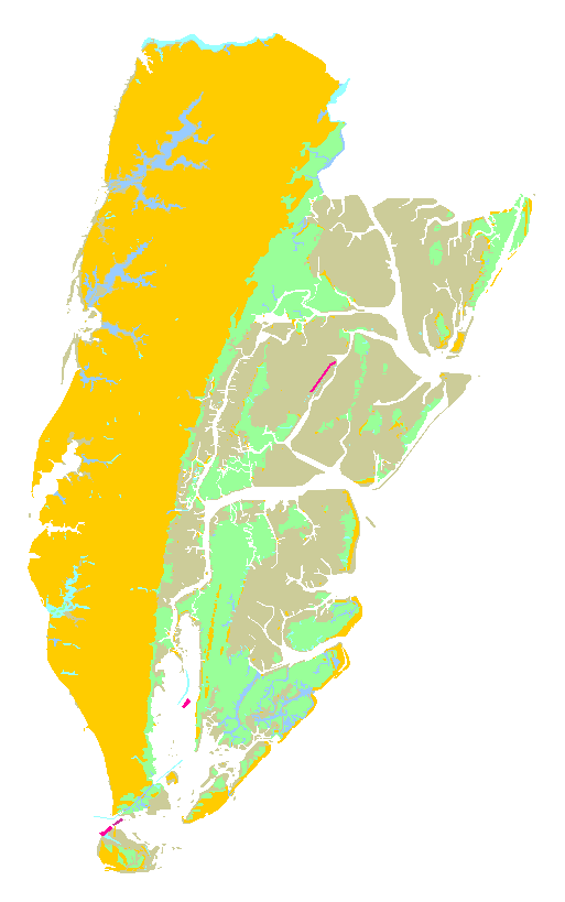
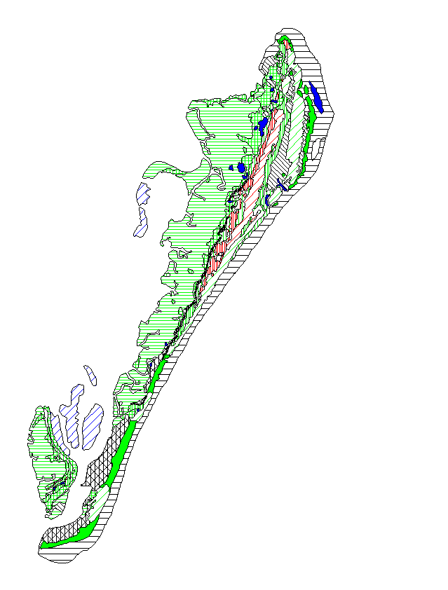
SOIL and LANDUSE
GENERAL SOIL MAP
1:190,000-Scale
(Outline is 1:100,000-scale)
ArcView coverage name: SOIL
Description: Soil type classification map, meant for general planning
purposes (four soil class types).
Click Here for Quick Metadata.
Click Here for Complete Metadata.
Click Here for ARCE data files.
Also available: ArcView coverage SOILORIG
Description: Identical to SOIL; with origional outline
boundary of 1:190,000-scale
Click Here for SOILORIG Graphic
Click Here for SOILORIG Quick Metadata
Click Here for SOILORIG Complete Metadata
Click Here for ARCE data files.
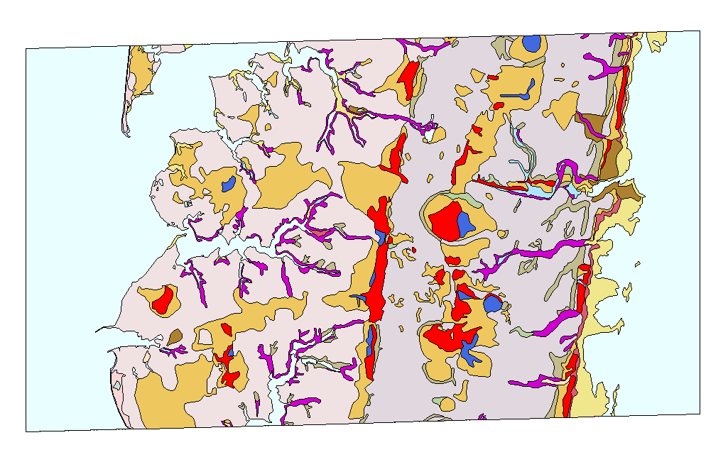
DETAILED SOIL MAP
CAPE CHARLES AREA

ArcView coverage name: CC_SOIL
1:15,540-scale
Description: Soil Conservation Survey Detailed Soil Map

Box identifies location of detailed area.
Click Here for CC_SOIL Quick Metadata
Click Here for CC_SOIL Complete Metadata
Click Here for ARCE data files.
VCR LANDUSE
and VEGETATION COVER
1993

Arc file: NHTM93S3
Description: Landuse and
vegetation cover derived
x
from satelite TM image.
5 classes:
Forest/shrub
Bare/Sand
Crop/Grassland
Water
Salt Marsh
Polygon coverage.
100x100 ft. approximate
resolution.
Click Here for Quick Metadata.
Click Here for Complete Metadata.
Click Here for ARCE data files.
BACK to MAIN MENU
PLANT ASSOCIATIONS
for the BARRIER ISLANDS
1:20,000-scale
Description: Vegetation maps and descriptions of
plant associations compiled for 16 barrier and marsh
islands on the seaward margin of the Delmarva Peninsula.
The islands which are not part of Northampton County
have not been prepared for this document and image set,
but may be obtained from the VCR-LTER
 HOG ISLAND PLANT ASSOCIATIONS
ArcView coverage name: hog
 COBB ISLAND PLANT ASSOCIATIONS
ArcView coverage name: cobb
 WRECK ISLAND PLANT ASSOCIATIONS
ArcView coverage name: wreck
 SHIP SHOAL ISLAND PLANT ASSOCIATIONS
ArcView coverage name: ships
 MYRTLE ISLAND PLANT ASSOCIATIONS
ArcView coverage name: myrtle
 SMITH ISLAND PLANT ASSOCIATIONS
ArcView coverage name: smith
Click Here for Quick Metadata.
Click Here for Full Metadata.
Click Here for ARCE data files.
.
BACK to MAIN MENU
BIRD NESTING SITES

ArcView coverage name: birds
Description: Bird nesting sites for 1993.
Information includes:
location
species and common name
number of adults, chicks, eggs and nests
land owner and management area.
Note: Plover nesting sites are available,
but not included on this map.
Click Here for Quick Metadata.
Click Here for Full Metadata.
Note: Plover nesting sites are available,
but not included on this map.
BACK to MAIN MENU
EcoMap Coverages
 Hydrology
ArcView coverage name:emsp_hyd
 Drive
Drive
ArcView coverage name:em_drive
 Grid
Grid
ArcView coverage name:em_grid
Other EcoMap Coverages on file:
em_road1
em_road2
em_shore
em_swamp
em_trans
em_trib
Click Here for A note about the EcoMap dataset.
Click Here for ARCE data files.
BACK to MAIN MENU
Created by Anne L. Halpin and David L. Richardson.
Last updated 24 May 1995.


Department of Environmental Sciences
University of Virginia
Charlottesville, VA 22903
For additional information contact JPorter@lternet.edu or call:
804-924-8999.

 ROAD and TRAIL FEATURES
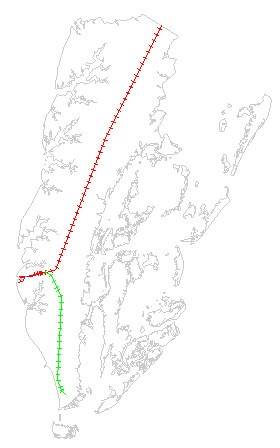 RAILROAD FEATURES
 MISC. TRANSPORTATION FEATURES
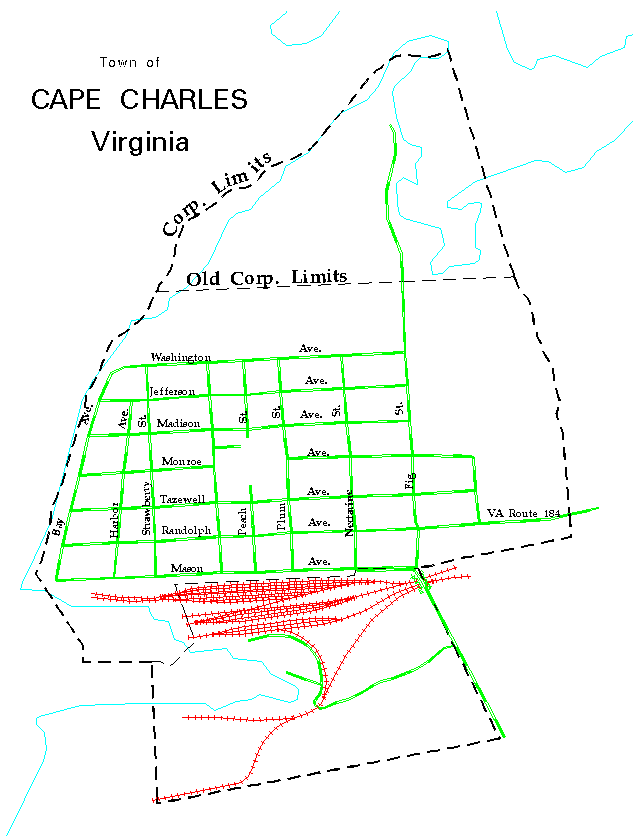


 HOG ISLAND PLANT ASSOCIATIONS
 COBB ISLAND PLANT ASSOCIATIONS
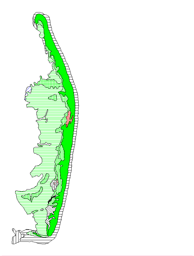 WRECK ISLAND PLANT ASSOCIATIONS
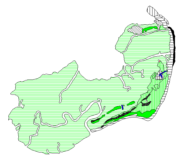 SHIP SHOAL ISLAND PLANT ASSOCIATIONS
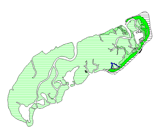 MYRTLE ISLAND PLANT ASSOCIATIONS
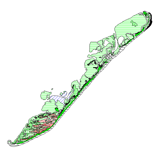 SMITH ISLAND PLANT ASSOCIATIONS
 Hydrology
 Drive
Drive Grid
Grid