
 |
Temporal and Spatial Dynamics of Crop - Weather Interactions in the Corn Belt |
| Stuart H. Gage |
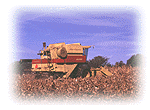
The "corn belt" in the United States is one of the most productive agricultural regions in the world. The region encompasses 12 midwestern states including Ohio, Indiana, Illinois, Missouri, Michigan, Wisconsin, Minnesota, Iowa, North and South Dakota, Nebraska and Kansas. The area has been cropped intensively since the discovery of the rich soil base and a climate conducive for the production of row crops among which are the crops previously government supported crops including corn, soybeans and wheat. The intense cultivation of these crops, including multiple year planting of crops like corn, has required increased management inputs of fertilizers, herbicides, insecticides and irrigation to sustain profitable production levels. Increasing pressures are being placed on the landscape to produce not only human food and livestock feed for US consumption and foreign export, but also the generation of biofuels to satisfy US energy demands.
Changes in the corn belt have been dramatic over the past quarter century. These changes in crop production practices have beed driven by economic incentives and the resulting resource depletions have not been without serious ecological consequences. The objectives are to assess the dynamics of crop productivity in the region caused by weather and cropping production practices and develop a regional model to guide policy makers toward a more ecologically based agricultural production system by indentifing sensitive ecosystems, vulnerable water resources and alternative cropping scenereos.
Models of biomass production at different scales of time and space are being linked to spatial ecological resources including water, soil, topography and ecosystems characteristics. Existing simulation models (Century, Ceres and QB maize) are being tested at three different spatial scales, (local, watershed, regional) and at three different time scales (daily, monthly and seasonally) to determine their ability to track and forecast biomass production of selected cropping systems grown n the region (corn, wheat, soybeans). Regional crop production, natural resources and meteorological databases have been compiled to assist in characterizing and modeling biomass in the region.
Data Explorer is being used at the San Diego Supercomputer Center to visualize the series of temporal and spatiall characteristics of the region. Monthly weather data derived from the daily observations in the US Corn Belt are being linked to biomass production models of crop productivity. Meteorological data has been organized to reflect daily, weekly and monthly changes in heat accumulated above 50F(10C).
The series below is based on a sequence of monthly accumulations of degree-day surfaces computed from daily maximum and minimum temperatures. The sequence below shows a sequence of the 12 months in 1972 and is a subset of a 20 year database. Data were processed at the San Diego Subercomputer Center.

The North Central USDA Regional Committee (NC94) consisting of members form the 12 state Land Grant Universitires and Federal representatives from NOAA, NRCS and NWS has developed region wide meteorological, crop and soils databases for regional assessment. A consortium of investigators from Michigan State University (Gage, Long, Colunga), Oregion State University (White), University of North Dakota (Osborne) and the Center for Resource Innovations (Maizel) with expertise in regional mapping, ecosystem assessment, and meteorological modeing have formed a cooperative to investigate ecosystems under stress and change. The San Diego Supercomputer Center (Helly) is providing expertise in modeling and visulaization to characterize regional modeling output.
Top | KBS Regionalzation | KBS LTER home page | The LTER network
For information contact: gages@pilot.msu.edu
Document author(s): Stuart Gage
E-Mail: gages@pilot.msu.edu
Revised: December 09, 1996
URL: http://www.ent.msu.edu/esal/lter_region