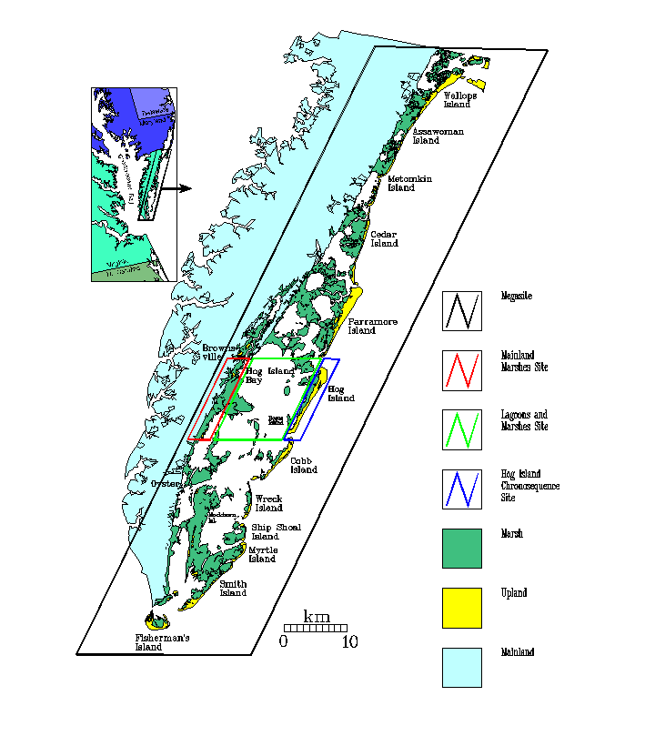
 Map of VCR/LTER Research Sites. 25 K
Map of VCR/LTER Research Sites. 25 K
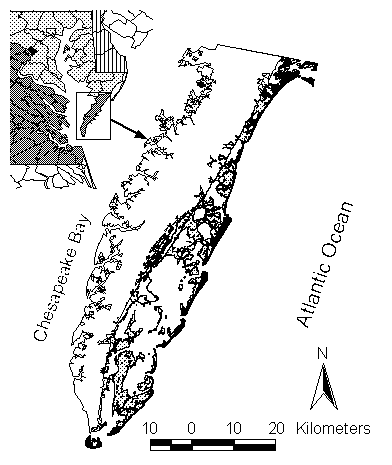
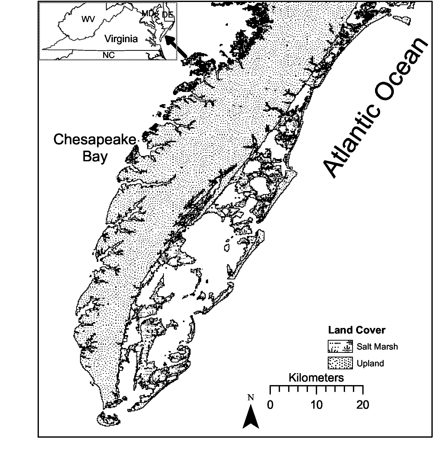 Black and white map of the Delmarva Peninsula. Also available as WORD
file
Black and white map of the Delmarva Peninsula. Also available as WORD
file
 Black and White Map of VCR/LTER Study Area. Also available as editable and printable
Rich Text, Word, Adobe Acrobat (.pdf) files.
Black and White Map of VCR/LTER Study Area. Also available as editable and printable
Rich Text, Word, Adobe Acrobat (.pdf) files.
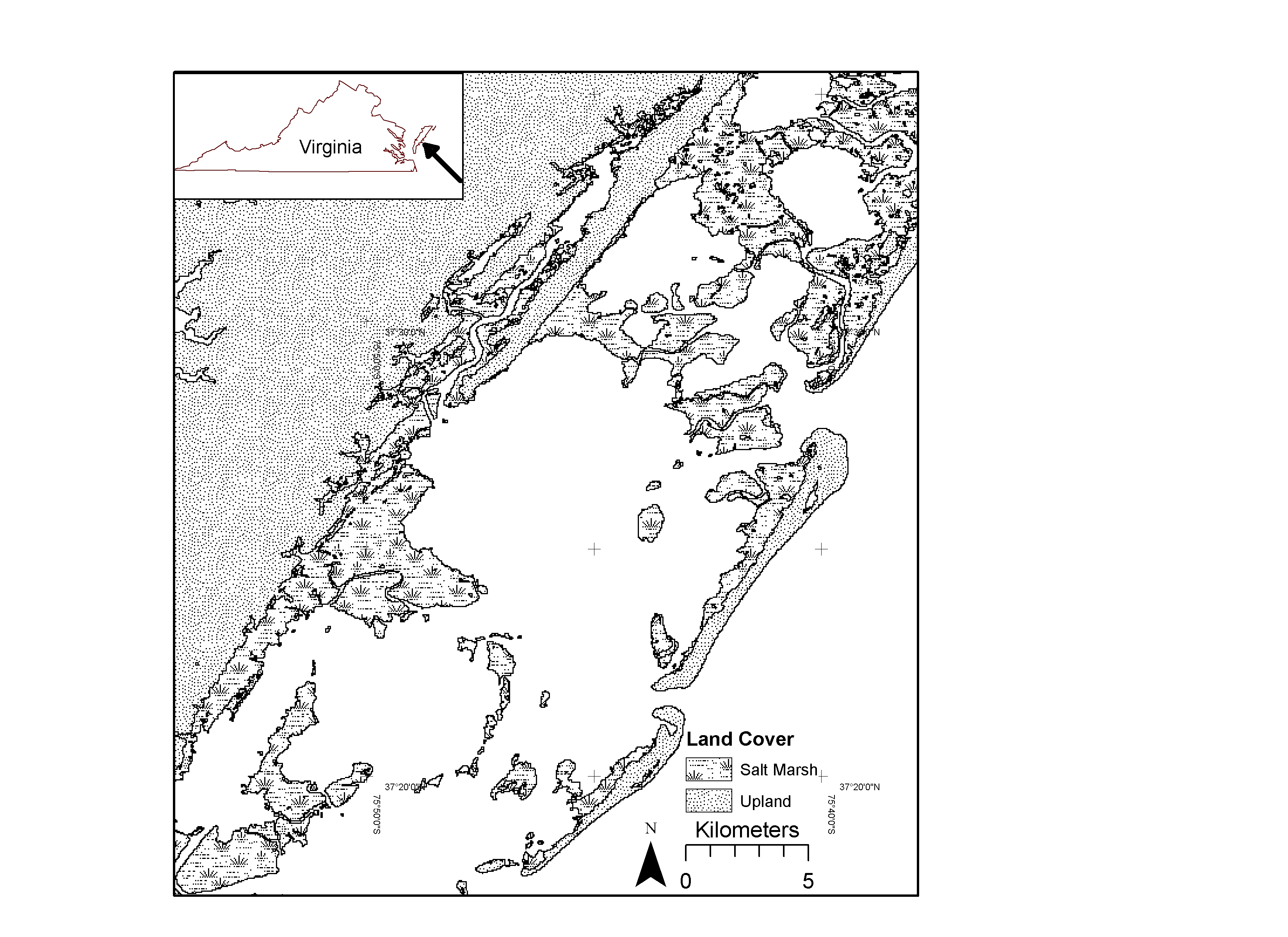 Black and White Map of Hog Island Bay. Also available as editable and printable
Word, Enhanced Windows Metafile (EMF),
files.
Black and White Map of Hog Island Bay. Also available as editable and printable
Word, Enhanced Windows Metafile (EMF),
files.
Black and White Map history of Hog Island 1963-1999 PDF file
Black and White Map history of Phillip's Creek 1963-1993 PDF file
Black and White Map history of Brownsville & Phillip's Creek 1963-1993 PDF file
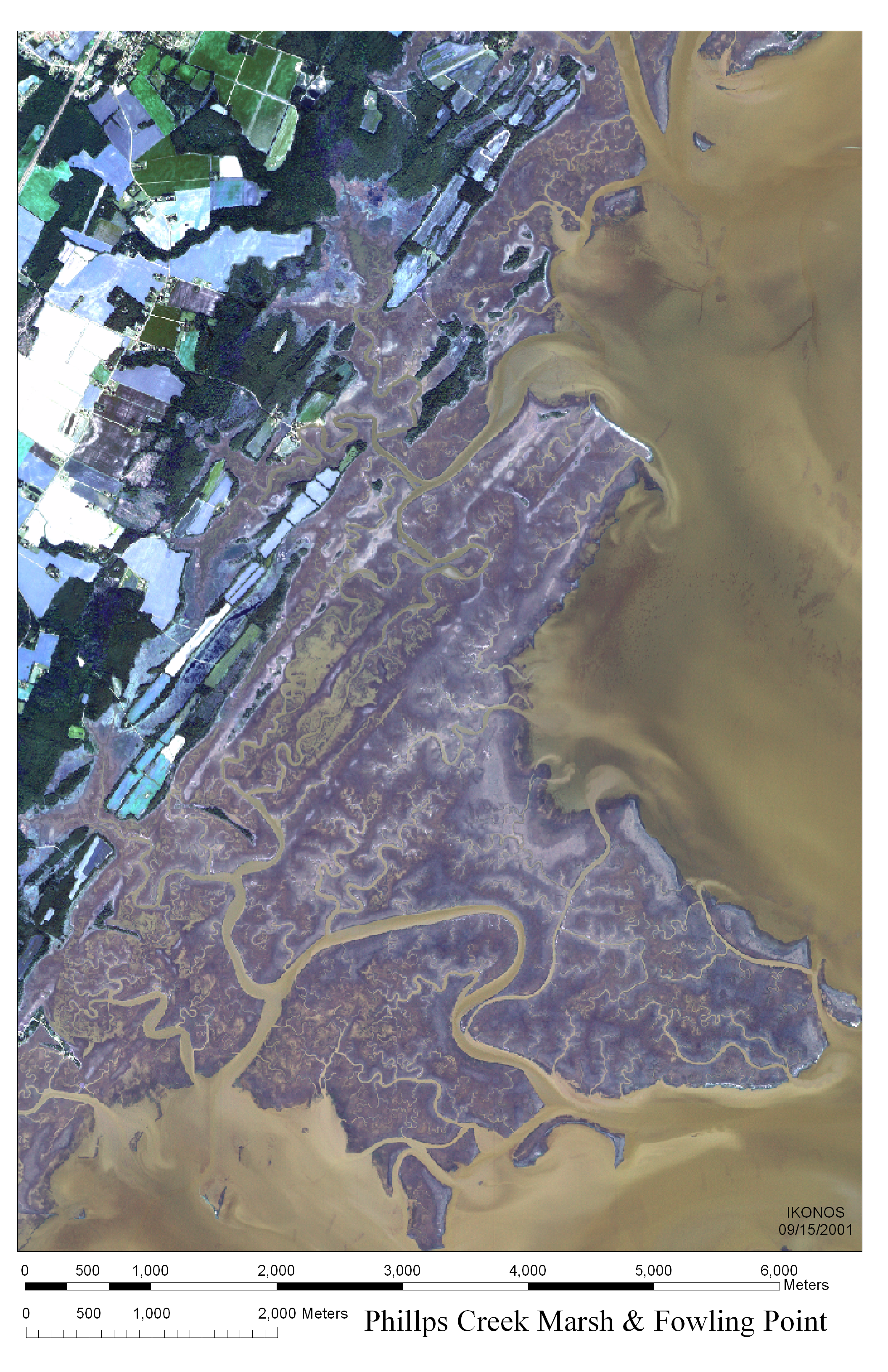
Fowling Point and Phillips Creek 2001 2MB PNG file
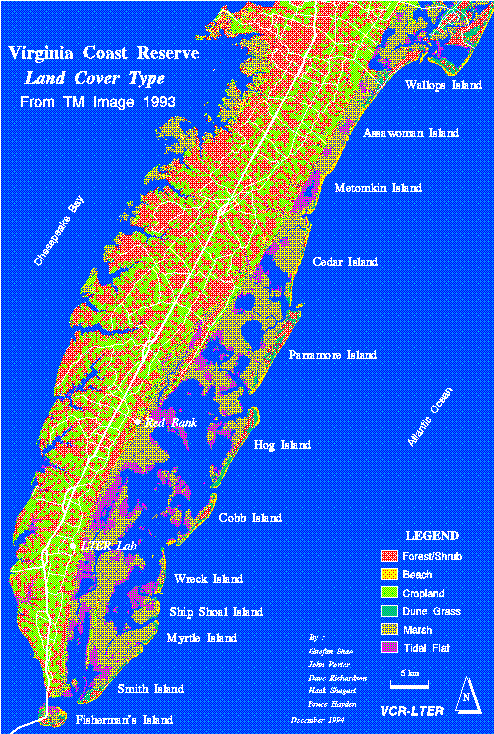 1993 land cover classification for Delmarva Penn. based on 93 TM image.
45 K
1993 land cover classification for Delmarva Penn. based on 93 TM image.
45 K
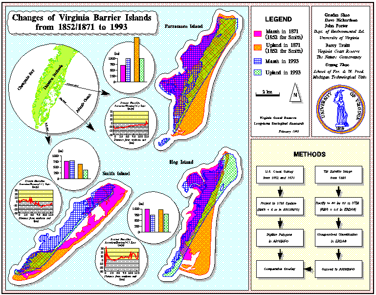 Changes of 3 VA barrier islands from 1852/1871 to 1993 (from poster presentation). Also available as high resolution PDF
45 K
Changes of 3 VA barrier islands from 1852/1871 to 1993 (from poster presentation). Also available as high resolution PDF
45 K
Poster showing landscape changes (shrub and shoreline) on Hog, Smith and Cobb Islands - PDF1 PDF1
Poster showing changes in shrub distribution on Hog Islands - PDF
Poster showing land cover and major roads for the Virginia portion of the Delmarva Peninsula - PDF
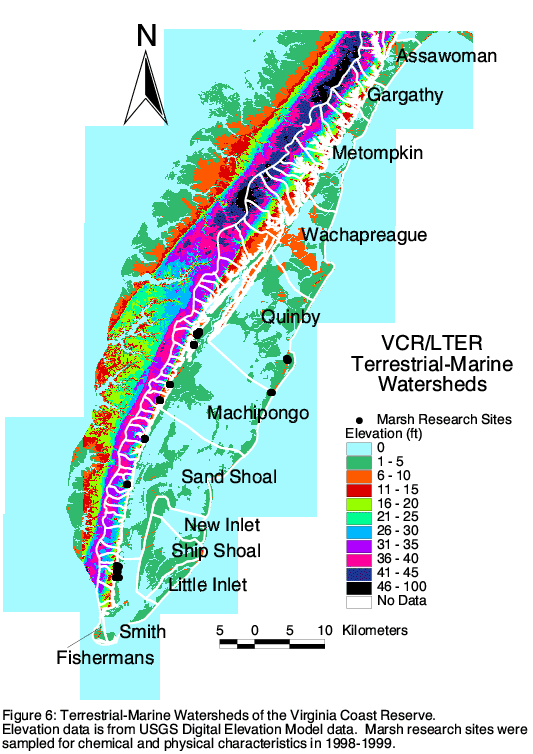 Delmarva Topography and Watersheds
61 MB (also available in larger size)
Delmarva Topography and Watersheds
61 MB (also available in larger size)
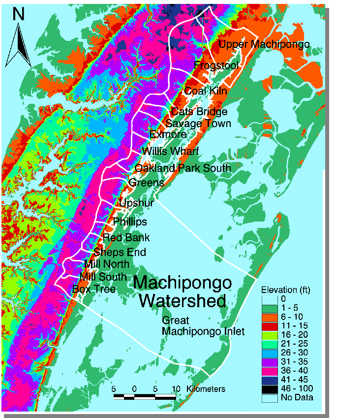 Topography and Watersheds in Machipongo Inlet Watershed
110 K
Topography and Watersheds in Machipongo Inlet Watershed
110 K
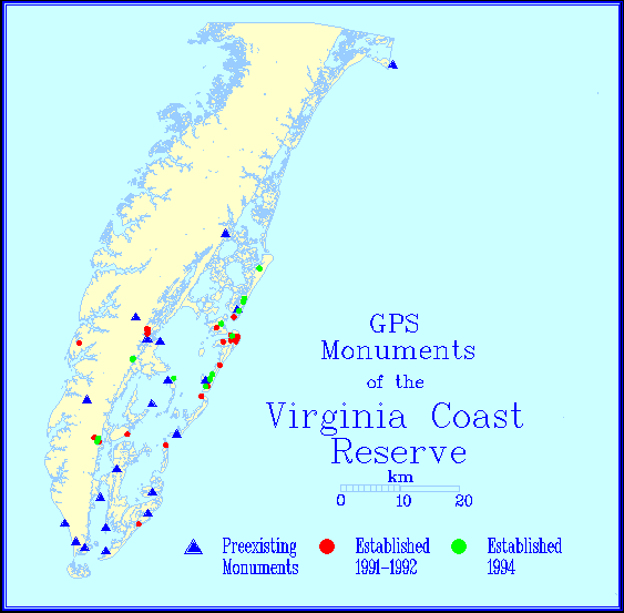 Map of GPS monuments of the VCR/LTER.
14 K
Map of GPS monuments of the VCR/LTER.
14 K
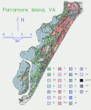
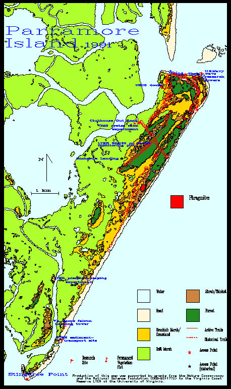 Map of research sites, trails, & phragmites patches on Parramore Is.
27 K
Map of research sites, trails, & phragmites patches on Parramore Is.
27 K
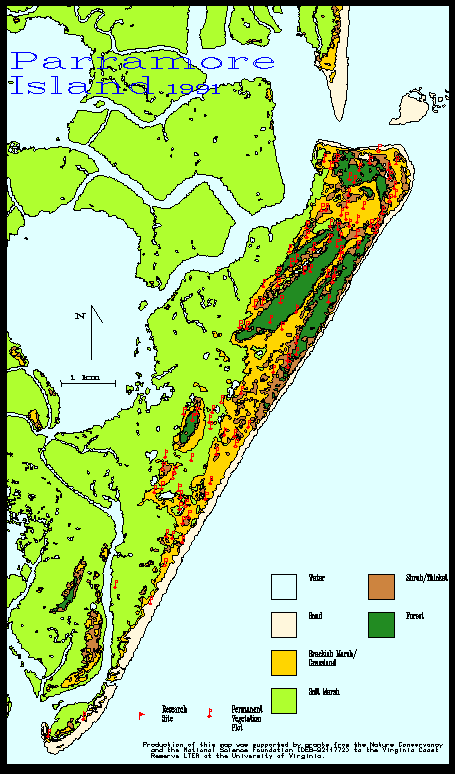 Map of permanent veg. plots on Parramore Island (est. 1993).
25 K
Map of permanent veg. plots on Parramore Island (est. 1993).
25 K
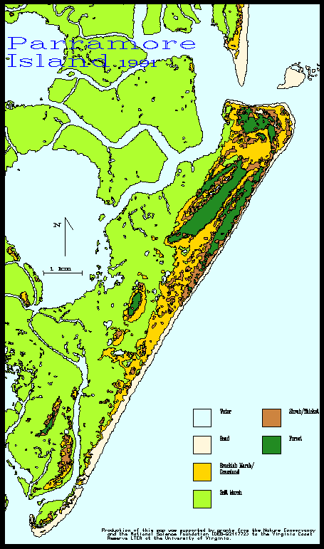 Vegetation Classification Map for Parramore Is. 1991.
24 K
Vegetation Classification Map for Parramore Is. 1991.
24 K
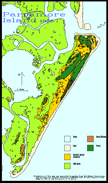 Vegetation Classification Map for Parramore Is. 1986.
22 K
Vegetation Classification Map for Parramore Is. 1986.
22 K
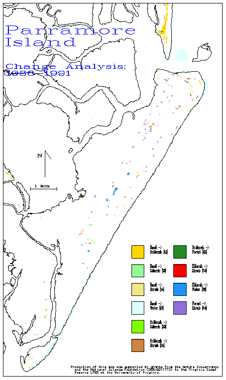 Map of vegetation change on Parramore Is. from 1986 to 1991.
16 K
Map of vegetation change on Parramore Is. from 1986 to 1991.
16 K
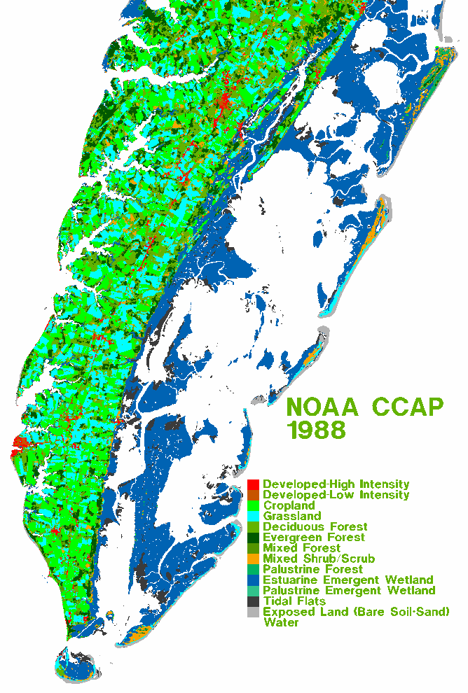 NOAA CCAP (Coastal Change Anaylsis Program) 1988 Landuse Map for the S. Delmarva Penninsula.
73 K
NOAA CCAP (Coastal Change Anaylsis Program) 1988 Landuse Map for the S. Delmarva Penninsula.
73 K
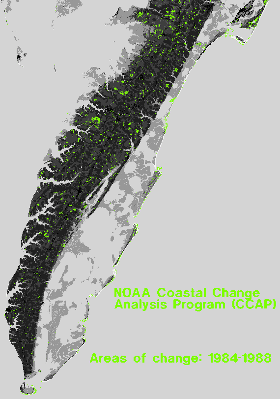 NOAA CCAP map showing areas of landuse change from 1984-1988 for the southern Delmarva Penninsula.
36 K
NOAA CCAP map showing areas of landuse change from 1984-1988 for the southern Delmarva Penninsula.
36 K
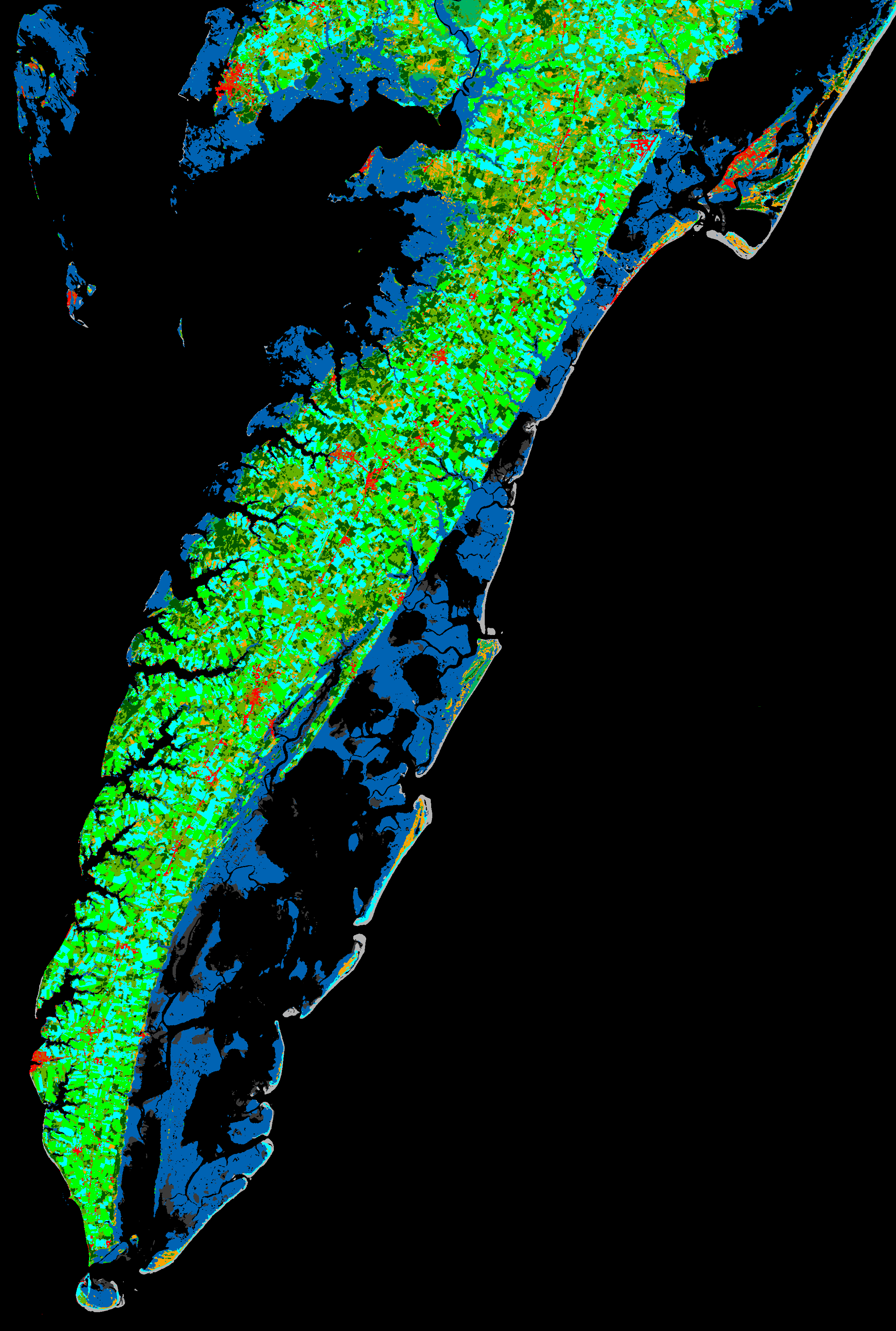 1988 NOAA CCAP classification of Delmarva Penninsula Assateague Island south.
494 K
1988 NOAA CCAP classification of Delmarva Penninsula Assateague Island south.
494 K
![]() VCR/LTER logo (b/w).
2 K
VCR/LTER logo (b/w).
2 K
![]() VCR/LTER logo (b/w reversed).
2 K
VCR/LTER logo (b/w reversed).
2 K
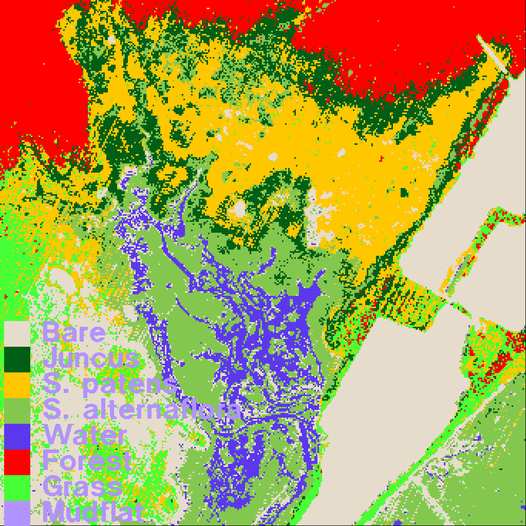 1990 Phillip's Creek Marsh, Unverified vegetation classification. J. Porter and L. Blum
2 K
1990 Phillip's Creek Marsh, Unverified vegetation classification. J. Porter and L. Blum
2 K
 Island Vegetation Maps - 1974