| Regionalization at the LUQ |
|
Authors: John R. Thomlinson, Frederick N. Scatena, Douglas A. Schaefer, and Robert B. Waide
Scientific Basis for Regionalization at the LUQ LTER Site
| Regionalization at the LUQ |
|
|
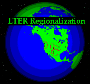
Our LTER study area is located in northeastern Puerto Rico, the smallest and most easterly of the Greater Antilles (Figure 1). The LEF covers approximately 11,000 ha, with elevations from 100 m to 1075 m above mean sea level. Rainfall varies from about 2500 mm to 4000 mm per year, generally increasing with elevation, and the mean annual temperature ranges from 25 deg C to 19 deg C, generally decreasing with increasing elevation. The LEF has seen a long history of human use, primarily for small-scale agriculture and charcoal production. Although these activities have been absent for at least 60 years, traces remain in current tree distribution patterns. Other predominant disturbances include landslides, which are frequent in the LEF, and hurricanes, which affect the LEF about every 60 years. Since the LTER site was established in 1988, Puerto Rico has experienced a major hurricane (Hugo in 1989) as well as historic drought (1994) and flood (1996). This extraordinary coincidence has provided great opportunities to study the effects of natural disturbances on biogeochemistry and biological communities. Long-term records of climate and forest growth in and near the LEF assist in putting current climate and extremes in a historical context.
Six of the 13 lifezones found in the Caribbean Basin are encountered in Puerto Rico. The geology of Puerto Rico consists mainly of volcaniclastics, with significant amounts of alluvial deposits, limestone, and intrusives. As such, examples of the geology of the greater part of the basin are represented on the island. Eleven of the twelve great soil orders are present in Puerto Rico, reflecting the diversity of its surficial geology and climate. Many of the Earth's tropical climates are represented as well, ranging from less than 1000 mm rainfall with strong seasonal drought on the south coast, to cloud forests in the LEF and the central mountains. Tropical climates not represented on the island are the lowland (equatorial) rain forest and the cooler climates to be found above 2000 m. In addition to undisturbed and secondary forests, Puerto Rico includes most tropical land-use types: urban (dense and sparse), selective-extraction forestry, plantation forestry, cattle pasture, sugar cane, rice, coffee, tobacco, bananas, pineapple, and other tropical crops. A regionalization approach therefore first encompasses the rest of Puerto Rico and then the whole of the Caribbean Basin.
By virtue of its location, the LEF is upstream of the general weather patterns that affect the maritime portion of the basin, both the easterly summer patterns and the northerly winter ones. This places us at the end of a number of environmental gradients. If we construct north-south transects down the Lesser Antilles or east-west transects through the Greater Antilles, we can investigate different controls on ecosystem processes, such as island size, hurricane frequency (Figure 2), maximum elevation, rainfall, isolation, winter temperatures, and so on.
Following European settlement, which began in the early 16th century, Puerto Rico experienced a decline in forest cover from a presumed state of almost total cover to a low of about 5 percent in the late 1940's. Most of the forest destruction was for agricultural development. Since then, however, there has been a movement off the land and into cities, and the forest cover has increased to about 30 percent of the island's area. Throughout the period of European settlement, the upper portion of the LEF has not been subjected to intensive human disturbance. Thus, another gradient (intensity of human land use) is provided, increasing in intensity as elevation decreases and distance from the center of the LEF increases. The land abandonment dynamic allows us the opportunity to study the processes that occur in tropical ecosystems when human pressures are reduced. We are also able to assess the resilience of these secondary forests to the "natural" disturbances such as hurricanes and landslides. The period of agricultural abandonment occurred over a sufficiently long time to give chronosequences of land-use change. With relatively complete data of abiotic conditions on the island, we are able to select sites that represent chronosequences under similar conditions, as well as comparing equal-age secondary forests under different conditions. Studies completed and currently underway illustrate the mechanisms of forest regrowth and the effects of different land-use legacies on ecosystem function and biodiversity.
Much of the Caribbean Basin continues to undergo deforestation, though with the shift towards a global manufacturing economy and the exhaustion of available agricultural land it seems likely that this trend will reverse. The lessons we learn from the land-cover dynamics in the LEF, and in Puerto Rico at large, will enable us to predict changes in biological communities and biogeochemical processes in other areas, given knowledge of environmental conditions in those areas.
Through its Experimental Program to Stimulate Competitive Research (EPSCoR), NASA has funded the Tropical Atmospheric Sciences Center (TASC), a collaboration among the ITES and the Departments of Biology and Chemistry, UPR Rio Piedras; the Marine Sciences Center and Departments of Chemistry, Electrical Engineering and Geology at UPR Mayaguez; the IITF; and the Arecibo National Astronomy and Ionosphere Center. This project examines chemical exchanges between the troposphere and terrestrial ecosystems, between the troposphere and marine ecosystems, and transport and chemical transformations in the troposphere itself. The goals of this project are to improve our understanding of atmospheric chemistry in the tropics and to establish the TASC as a focal point for related research in the future. This project provides another mechanism for scaling up across the region by considering the continuity of atmospheric and oceanic transport.
Brief summaries of some of the specific regional-context projects currently underway are given below.
Guanica Dry Forest. The Guanica Commonwealth Forest has been a forest reserve since 1919 and is recognized as an outstanding example of Caribbean dry forest ecosystems. The 4016 ha reserve is located in the subtropical dry forest life zone of southwest Puerto Rico and has a landscape that is a mixture of limestone hills separated by intermittent streams, alluvial fans, and valleys. Over the past 70 years annual rainfall has averaged 860 mm. Between the LEF and the Guanica Dry Forest there is thus a pronounced moisture gradient which mirrors that found on other Caribbean islands. Current work includes research on the dynamics of forests in response to both natural and anthropogenic disturbances, nutrient cycling, trace gas emissions, termites, neotropical birds, and other wildlife. Facilities include long-term plots and a GIS-based record of land-use change over the past 53 years (Lugo et al. 1996).
Hurricane effects. We are studying the patterns of hurricane damage in the LEF though surveys, analysis of air photos, and modeling, and relating these patterns to those seen throughout the tropics and in temperate zones (Foster and Boose 1995). Also, regional patterns of hurricane damage across Puerto Rico since the time of European settlement are being investigated through historical studies and modeling. Preliminary results suggest that there are strong damage gradients across the island resulting from each major hurricane (E. Boose, pers. comm.)
Biodiversity. The high degree of endemism on Caribbean islands coupled with broad-scale human disturbance have placed many animal species in the region in danger of extinction. At the same time, the generalist nature of island faunas and invasions of exotic species maintain or increase local biodiversity while regional diversity is decreasing. The effects of natural disturbances, particularly hurricanes, on these trends are being scaled up across the region (e.g. Wunderle et al. 1992).
Landslides. We are comparing patterns of revegetation and insect biodiversity on landslides on diverse substrates in Puerto Rico and Costa Rica (Myster 1996a, b), and ecosystem development and plant succession on landslides across the Caribbean Basin (Walker et al. 1996).
Effects on hydrologic systems. We are comparing stream flow, chemistry, morphology, and sedimentation rates in streams in the LEF, at other locations in Puerto Rico, on other islands in the Caribbean Basin (Ahmad et al. 1993, McDowell et al. 1995), and on the mainland of Central America (Pringle and Scatena 1996). Furthermore, through collaborations with the Free University of the Netherlands, we are comparing cloud-forest hydrology between Puerto Rico and Jamaica.
Carbon cycling. The importance of tropical forests as a sink for atmospheric carbon is now recognized (Lugo 1992), and the increasing size of that sink as forests regenerate has been noted (Lugo and Brown 1992). The regeneration of forests in Puerto Rico provides a model for this process in areas that are still undergoing deforestation or are only just starting to regenerate.
Anthropogenic land-use change. In the early 1900's, the Puerto Rican landscape was dominated by sugar cane, coffee, pastures, tobacco, and bananas. Economic changes have lead to the abandonment of most agricultural lands, increased urbanization, and the regeneration of forested ecosystems. Researchers are identifying patterns of secondary succession following different land-use practices at numerous sites across the island (e.g. Aide et al. 1996) and spatial patterns of forest regeneration on the flanks of the LEF (Thomlinson et al. 1996). Other Caribbean islands are currently subject to human land uses similar to those extant or recent in Puerto Rico, for example, agriculture or charcoal production. All the diverse information obtained through these studies will be used as the basis for developing management strategies for forest and agricultural lands throughout the Caribbean Basin.
Soil and water properties. As part of NASA-IRA and other projects, we are examining soil physical properties such as density, texture, and water infiltration rate; chemical properties, e.g. organic matter, carbon and nitrogen pools (Brown and Lugo 1990); and biological properties, such as nitrogen mineralization and fluxes of nitrogen oxides and methane, in plots across Puerto Rico to provide information on the relationship between land-use intensity and duration and the recovery of ecosystem properties relevant to the global environment.
Climate change. The links between tropical land use or other disturbances and the regional or global climate are being studied in a number of ongoing projects, including the NASA-IRA. Aspects include climatic driver variables, greenhouse gas fluxes and controls, termite effects on greenhouse gas emissions, atmospheric reactions and fates of greenhouse gases, and the use of epiphytes as indicators to monitor atmospheric change (Lugo and Scatena 1992).
Aide, T. M., J. K. Zimmerman, M. Rosario, and H. Marcano. 1996. Forest recovery in abandoned cattle pastures along an elevational gradient in northeastern Puerto Rico. Biotropica. In press.
Brown, S., and A. E. Lugo. 1990. Effects of forest clearing and succession on the carbon and nitrogen content of soils in Puerto Rico and US Virgin Islands. Plant and Soil 124:53-64.
Foster, D. R., and E. R. Boose. 1995. Hurricane disturbance regimes in temperate and tropical forest ecosystems. In M. P. Coutts and J. Grace, editors. Wind and Trees. Cambridge University Press, Cambridge, UK.
Lugo, A. E. 1992. The search for carbon sinks in the tropics. Water, Air and Soil Pollution 64:3-9.
Lugo, A. E., and S. Brown. 1992. Tropical forests as sinks of atmospheric carbon. Forest Ecology and Management 54:239-255.
Lugo, A. E., O. Ramos, S. Molina, F. N. Scatena, and L. L. Vélez-Rodríguez. 1996. A fifty-three year record of land-use change in the Guanica forest biosphere reserve and its vicinity. International Institute of Tropical Forestry, USDA Forest Service, Rio Piedras, PR.
Lugo, A. E., and F. N. Scatena. 1992. Epiphytes and climate change research in the Caribbean: a proposal. Selbyana 13:123-130.
McDowell, W. D., A. E. Lugo, and A. James. 1995. Export of nutrients and major ions from Caribbean catchments. J. N. Amer. Benthol. Soc. 14: 12-20.
Myster, R. W. 1996a. Landslide insects show small differences between an island (Puerto Rico) and the mainland (Costa Rica). Acta Cientifica. In press.
Myster, R. W. 1996b. Seed predation, disease and germination on landslides in Puerto Rico and Costa Rica. Journal of Vegetation Science. In press.
Pringle, C. M. and F. N. Scatena. 1996. Factors affecting aquatic ecosystem deterioration in Latin America and the Caribbean with emphasis on Costa Rica and Puerto Rico. In U. Hatch and M. E. Swisher, eds. Tropical managed ecosystems: new perspectives on sustainability. Oxford University Press, Oxford, UK. In press.
Thomlinson, J. R., M. I. Serrano, T. del M. López, T. M. Aide, and J. K. Zimmerman. 1996. Land-use dynamics in a post-agricultural Puerto Rican landscape (1936-1988). Biotropica. In press.
Walker, L. R., D. J. Zarin, N. Fetcher, R. W. Myster, and A. H. Johnson. 1996. Ecosystem development and plant succession on landslides in the Caribbean. Biotropica. In press.
Wunderle, J. M., D. J. Lodge, and R. B. Waide. 1992. Short-term effects of Hurricane Gilbert on terrestrial bird populations in Jamaica. Auk 109:148-166.