350 Year Hog Island History
|
|
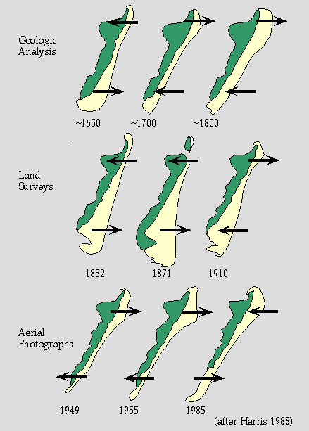
When the north end of Hog Island erodes landward the south end builds seaward and visa versa. Scientists at the LTER program at the Virginia Coast Reserve have demonstrated these reversals using measurements from aerial photographs (1949-present), from land surveys (1852-1949), from geological field studies of the landforms on the island. The current tendency to use erosion rates of the recent past to gauge the risks to be faced in the future are risky. It is also risky to assume that environmental changes of our modern times to be the causes of all change.
The lead in this study was Scott Harris. Scott completed his geological studies for a masters degree with support form the National Science Foundation on the LTER program at the Virginia Coast Reserve. Scott is not working on his PhD at the University of Delaware.